


01 Langford Farms Club Voting District, Wilson County, Tennessee
About
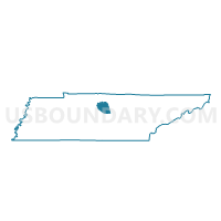
Outline

Summary
| Unique Area Identifier | 670031 |
| Name | 01 Langford Farms Club Voting District |
| County | Wilson County |
| State | Tennessee |
| Area (square miles) | 2.13 |
| Land Area (square miles) | 1.65 |
| Water Area (square miles) | 0.48 |
| % of Land Area | 77.47 |
| % of Water Area | 22.53 |
| Latitude of the Internal Point | 36.23787960 |
| Longtitude of the Internal Point | -86.58225020 |
Maps


Graphs
Select a template below for downloading or customizing gragh for 01 Langford Farms Club Voting District, Wilson County, Tennessee


Neighbors
Neighoring Voting District (by Name) Neighboring Voting District on the Map
- 02 St. Stephens Catholic Comm. Voting District, Wilson County, TN
- 08 Lakeside Voting District, Sumner County, TN
- 08 Lighthouse Assembly of God Voting District, Wilson County, TN
- 09 Indian Lake Voting District, Sumner County, TN
- 11-3 Andrew Jackson School Voting District, Davidson County, TN
- 12-1 Hermitage Presby Church Voting District, Davidson County, TN
Top 10 Neighboring County Subdivision (by Population) Neighboring County Subdivision on the Map
- District 12, Davidson County, TN (20,753)
- District 11, Davidson County, TN (16,649)
- District 9, Sumner County, TN (12,843)
- District 8, Sumner County, TN (11,100)
- District 2, Wilson County, TN (5,354)
- District 8, Wilson County, TN (3,725)
- District 1, Wilson County, TN (3,579)
Top 10 Neighboring Place (by Population) Neighboring Place on the Map
- Nashville-Davidson metropolitan government (balance), TN (601,222)
- Hendersonville city, TN (51,372)
- Mount Juliet city, TN (23,671)
- Green Hill CDP, TN (6,618)
Top 10 Neighboring Unified School District (by Population) Neighboring Unified School District on the Map
- Nashville-Davidson County School District, TN (626,681)
- Sumner County School District, TN (160,645)
- Wilson County School District, TN (84,298)
Top 10 Neighboring State Legislative District Lower Chamber (by Population) Neighboring State Legislative District Lower Chamber on the Map
- State House District 57, TN (84,276)
- State House District 45, TN (72,256)
- State House District 51, TN (62,965)
Top 10 Neighboring State Legislative District Upper Chamber (by Population) Neighboring State Legislative District Upper Chamber on the Map
- State Senate District 18, TN (222,166)
- State Senate District 17, TN (208,424)
- State Senate District 20, TN (194,112)
Top 10 Neighboring 111th Congressional District (by Population) Neighboring 111th Congressional District on the Map
Top 10 Neighboring Census Tract (by Population) Neighboring Census Tract on the Map
- Census Tract 212.01, Sumner County, TN (6,666)
- Census Tract 303.04, Wilson County, TN (6,425)
- Census Tract 211.03, Sumner County, TN (5,762)
- Census Tract 154.01, Davidson County, TN (5,642)
- Census Tract 303.05, Wilson County, TN (5,367)
- Census Tract 303.08, Wilson County, TN (4,819)
- Census Tract 154.05, Davidson County, TN (4,401)